As the oldest park in Africa, Menagesha is just a stone’s throw from Addis Abeba. The park dates back to the reign of Emperor Zera Ya’eqob, from 1434 to 1468, when he originally designated it a crown forest. Its name was changed a few years ago from Menagesha-Suba Forest Development Centre to the Finfine Forest Enterprise, SubaSebeta Forest Area Office.
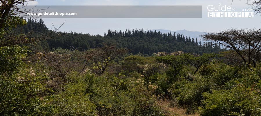
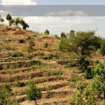
In the park, the lower slopes of Mount Damocha are covered with plantation forests, which form a buffer zone for its natural forest, higher up the mountainside that featuring a wide variety of native tree species.
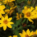
While the plantation areas are largely devoid of undergrowth, these natural areas of forest are rich with many different types of smaller trees, bushes, shrubs, groundcovers, and flowers, including big red onion-like flowers that grow from a single stem protruding from a bulb. At the top of the mountain are medicinal red-hot poker flowers.
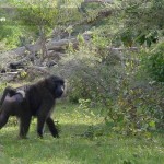
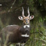
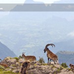
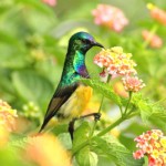
All these provide a rich habitat for many animals, including the endemic Menelik’s bushbuck, anubis baboon, guereza (colobus monkey), bush pig, warthog, leopard, and serval cat, for example. Many different types of birds, including endemics and semiendemics, can also be seen.
From Addis Abeba, the park can be accessed from the town of Sebeta, just outside the capital. There are many minibuses, midi buses, and large buses that pass through the town, many on the way to Jimma, which can drop passengers off in Sebeta at the turnoff for the road to Suba, a village on the edge of the forest.
The cheapest public transport is Anbessa City Bus 62, which costs only a few Birr from the city centre. A sign for the park marks the road to Suba just beyond Bus 62’s last stop on the right-hand side of the road. The bottom of the green sign proclaims, “The Oldest Park in Africa.” The road to Suba is a left-hand turn 300m past a right-hand turn on a small paved side road just off the main road to Jimma. It is a 17km trek to Suba from there.
The park can also be accessed from Ambo Road in Holeta. The turnoff is marked by a sign for an agricultural research centre on the left side of the road just after the newly paved road on the right-hand side that leads to Mugher Cement Factory. It is also about 17km to Suba from there.
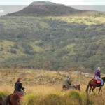
Above the main park office, the road leads past a nice campsite surrounded by towering native junipers, with a shelter, fire pit, and (soon) a composting toilet. Shortly thereafter, it branches, with one long road leading to a modest six-meter waterfall that mainly runs during kremt (the main wet season). Yellow-fronted parrots can also be seen here. The other main forest road leads to the upper edge of the forest where there is a museum and a safely guarded place to park vehicles in the shade during treks to the 3,385m summit of Mt. Damocha.
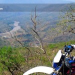
The mountain is an eroded volcanic crater with a jagged rim surrounding the valley floor far below. The valley features a drainage stream that comes out just to the right of the museum and provides an easy, well-worn route past the lower peaks that hide the real summit (from the vantage point of the park). This trail ends at a tiny mountain village, and, unfortunately, the hike to the summit from there is steep and lacks a wellworn trail.
The other option is to head left up the outer wall of the crater, though, this may entail a bit of up and down along the ridge of the crater before the true summit is reached. One benefit of taking the latter route is that it leads past some of the last remaining patches of giant heather trees as well as beautiful clear blue tarns.
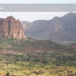
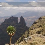
The summit is very windy and is especially cold if there is any cloud cover, whatsoever. The billowing clouds stream right up and over the top of the mountain from below. The scenes created are similar to those of the Bale and Simien Mountains.
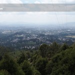
If the clouds do let up, a view of Addis Abeba can also be seen. If fact, one return option is to simply walk down the mountain towards the edge of the city, only 13km away. This can also be done in reverse.


Recent Comments