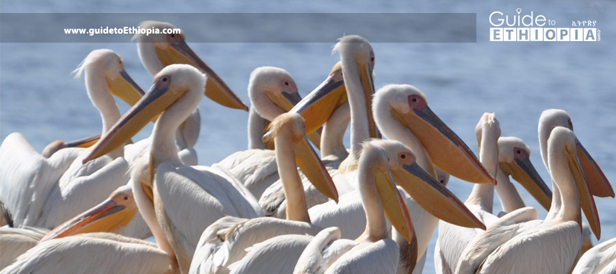
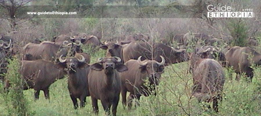
Abiata-Shalla Lakes National Park
7o30’ N/38o30’ E Comprised of two lakes (Abiata and Shalla), the park was established in 1970 for its many species of aquatic birds, particularly great white pelicans and greater and lesser flamingos. With two lakes hosting 400 bird species (half the total number of bird species in Ethiopia), the park includes 4,820ha of aquatic habitat. […]
Awash National Park
8°45’-9°15’N/39°45’-40°05’E The Park takes its name from the Awash River, which marks its southern boundary. It is one of Ethiopia’s oldest national parks, established in 1966. Elevation ranges from 750m to 2,010m above sea level, with the average altitude hovering around 1,000m. Short rains are expected from February to April and long rains from June […]
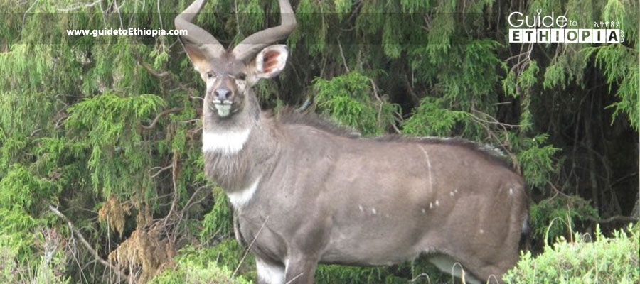
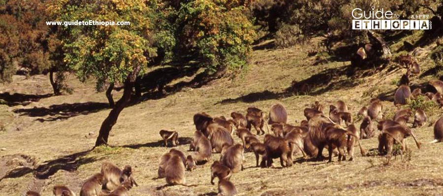
Bale Mountains National Park
6°29’-7°10’N/39°28’-39°57’E Established in 1970 to protect and conserve two endemic mammals, the mountain nyala and Ethiopian wolf, Bale Mountains National Park is divided into three major ecological zones. These are the northern grasslands and woodlands, the central highland afro-alpine areas and moorlands, and the Harenna Forest, which is a unique closed canopy forest. The highest […]
Gambella National Park
7°30’-08°15’N/33°45’-34°15’E It was established as a protected area in 1973 to conserve a diverse assemblage of wildlife and unique habitats. It is the largest protected area in the country. The general landscape is flat, and the average altitude is around 500m above sea level. The climate is hot and humid. The annual mean temperature is […]
Mago National Park
5°18’-05°56’N/35°56’-36°26’E Mago is as much a cultural park as a natural park, divided in half by the Mago River, a tributary of the Omo River. It was established in 1981 and consists largely of wooded grassland, bush land, and riverine vegetation. Altitudes range from 450m to 2,528m above sea level. The highest point in the […]
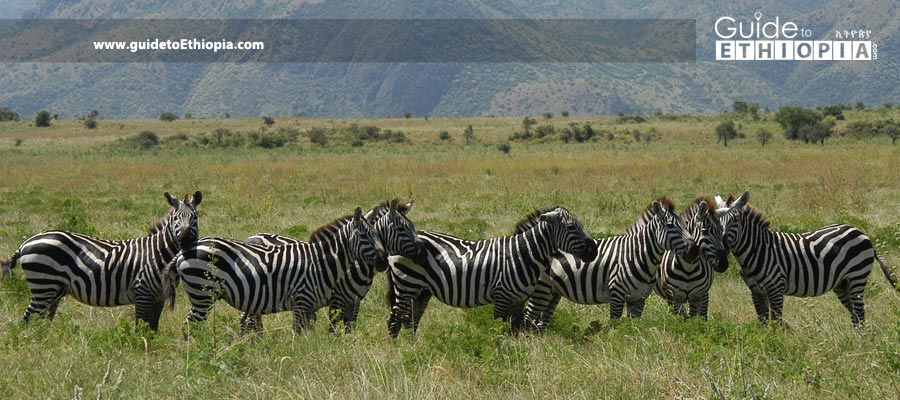
NechSar National Park
6°00’N/37°45’E NechSar is named after the creamy white grass that covers the park in the central plains area. It was established in 1974. The park is challenged by human settlement but offers the tourist a wide selection of wildlife and birds. Water bodies, including lakes Abaya and Chamo, cover about 15% of the park’s surface […]
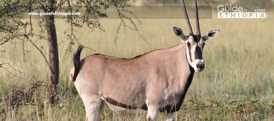
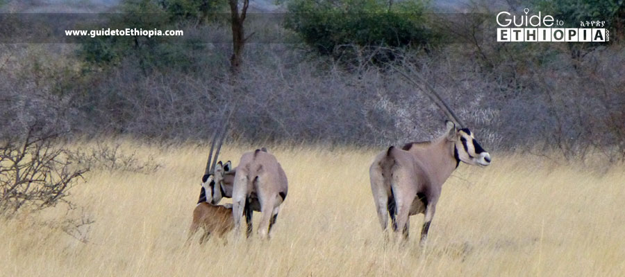
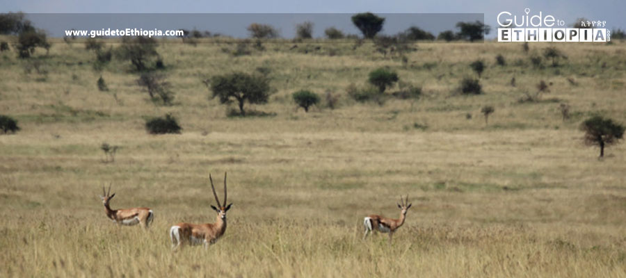
Omo National Park
5°30’-6°40’N/35°20’-36°00’E Enter the cultural and natural hotspot of Omo National Park and Omo Valley for the experience of a lifetime. It boasts one of the best wildlife concentrations in the country, established in 1966. Elevation, on average is around 500m above sea level, but Mountain Maji reaches a height of 1,541m. Rainfall is close to […]
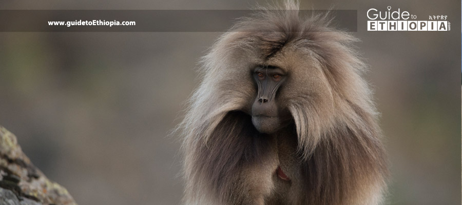
Simien Mountains National Park
13°11’N/38°04’E Established in 1969, this UNESCO World Heritage Site has a 60km escarpment along the Simien Mountains Plateau, which dominates the scenery. RasDejen (Dashen) Mountain is the highest point in the country. Elevation ranges from 1,900m to 4,543m above sea level. Average temperatures range from lows of -2.5 to four degrees C to highs of […]
Yangudi-Rassa National Park
10°30’-11°30’N/40°30’-44°00’E The park, established in 1976, is situated in the Great Rift Valley covered with grassland, bush, and thorn thickets. It has an average altitude of 500m above sea level, and the climate of the park is and hot and dry for the larger part of the year. Temperatures can rise to 43 degrees C […]
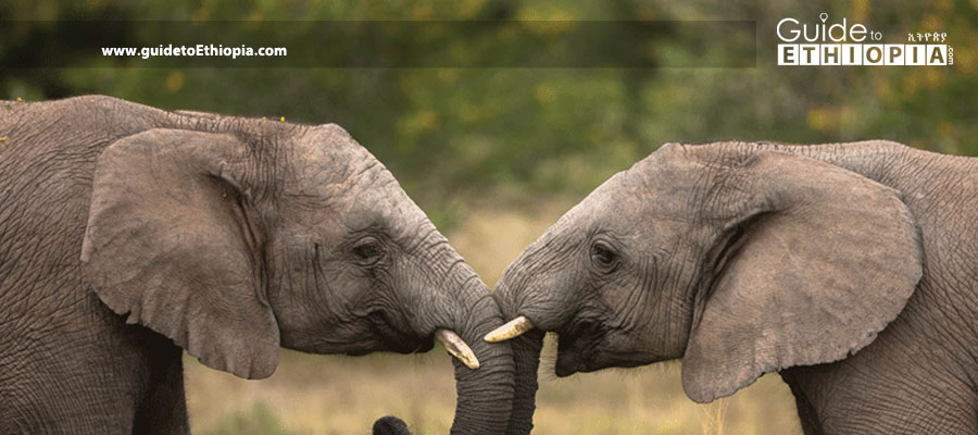
KaftaShiraro National Park
13°45’-14°15’N/37°15’-38°45’E Established in 2007, elevation ranges from 550m above sea level on the edge of the Tekaze River to 1,800m above sea level on the highlands of Kafta. It has a semiarid climate. The park is known to support an elephant population, as well as many mammal and bird species. It is still under development. […]
Maze National Park
6°03’N/37°40’E Maze National Park was established in 2005. Maze formerly served as a hunting area for Swayne’s Hartebeest. Altitude ranges from 1,000m to 1,200m above sea level. The rainy season extends from March to September, estimated at 800mm to 1,600mm per annum. Location: 490km south of Addis Abeba (235km southwest of Hawassa), in Gamo-Gofa Zone. […]
Babile Elephant Sanctuary
8°45’N/42°38’E Location: 557km east of Addis Abeba in Somali and Oromia regional states. Size: 6,987sqkm. Entry: Pass through Erer Valley and Gubele Valley. Hours: 3:30am to 6:30pm. When to Go: July up to the end of September is best. Things to See and Do: Track elephants and Swayne’s hartebeests among the unique physical features of […]
Geraille National Park
3°35’-4°52’N/39°26’-40°00’E This is a new park established in 2006. It has a low human population of pastoralist Somali tribes. Altitude ranges from 800m above sea level on the banks of the Dawa River to 1,380m above sea level on top of the escarpments. The whole area is found within a semiarid zone and is characterized […]
Chebera-Churchura National Park
6°56’-7°08’N/35°55’-36°37’E This is a new park established in 2005 to protect the declining population of elephants. Elevation ranges from 700m to 2,540m above sea level. Rainfall ranges from 1,200mm to 2,300mm per annum, and the temperature ranges from 10 to 29 degrees C. The wet season is from March to September, and the dry season […]
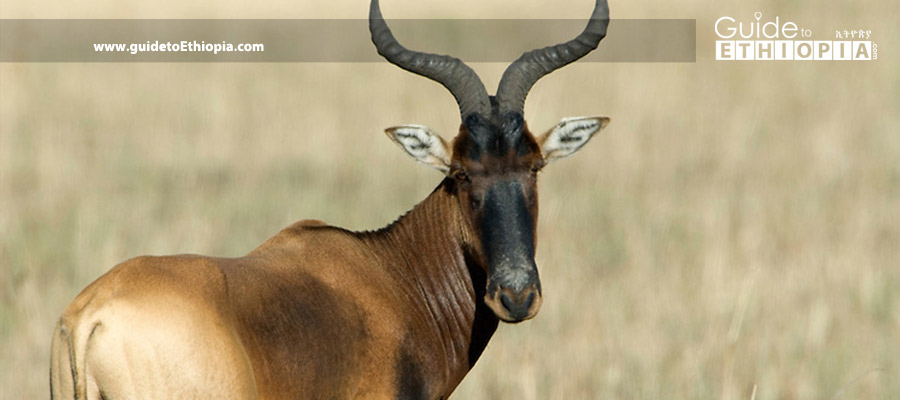
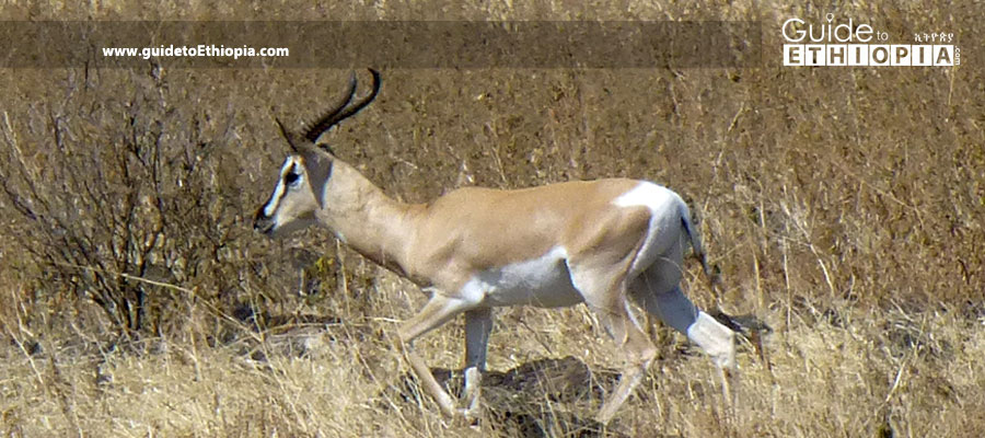
Senkele Swayne’s Hartebeest
Sanctuary7°11’N/38°20’E Originally established to protect the swaynes hartebeest, the open acacia woodland of the park is quite scenic, and some of animals are fairly easily spotted. Location: 340km south of Addis Abeba in Oromia and Southern Nations regional states. Size: 54sqkm. Hours: All day. Entry: From Shashemene. When to Go: From October to the end […]
Recent Comments